The System of Public Spaces in La Plata.
Public space analysis · GIS · Spatial indicators · Urban landscape quality
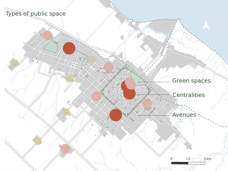
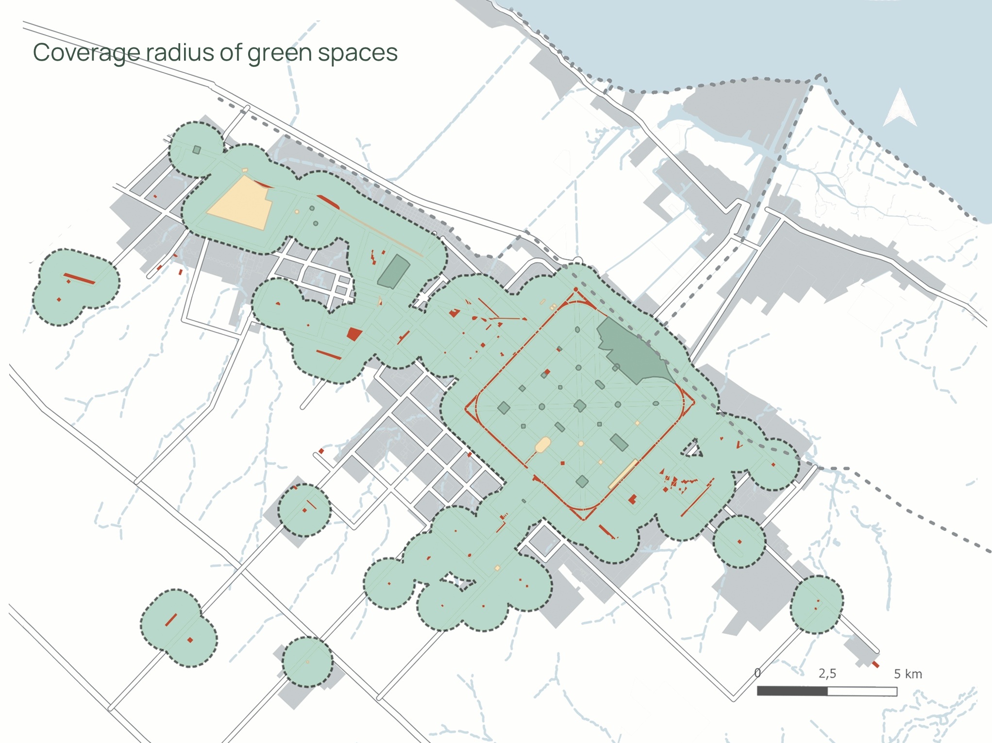
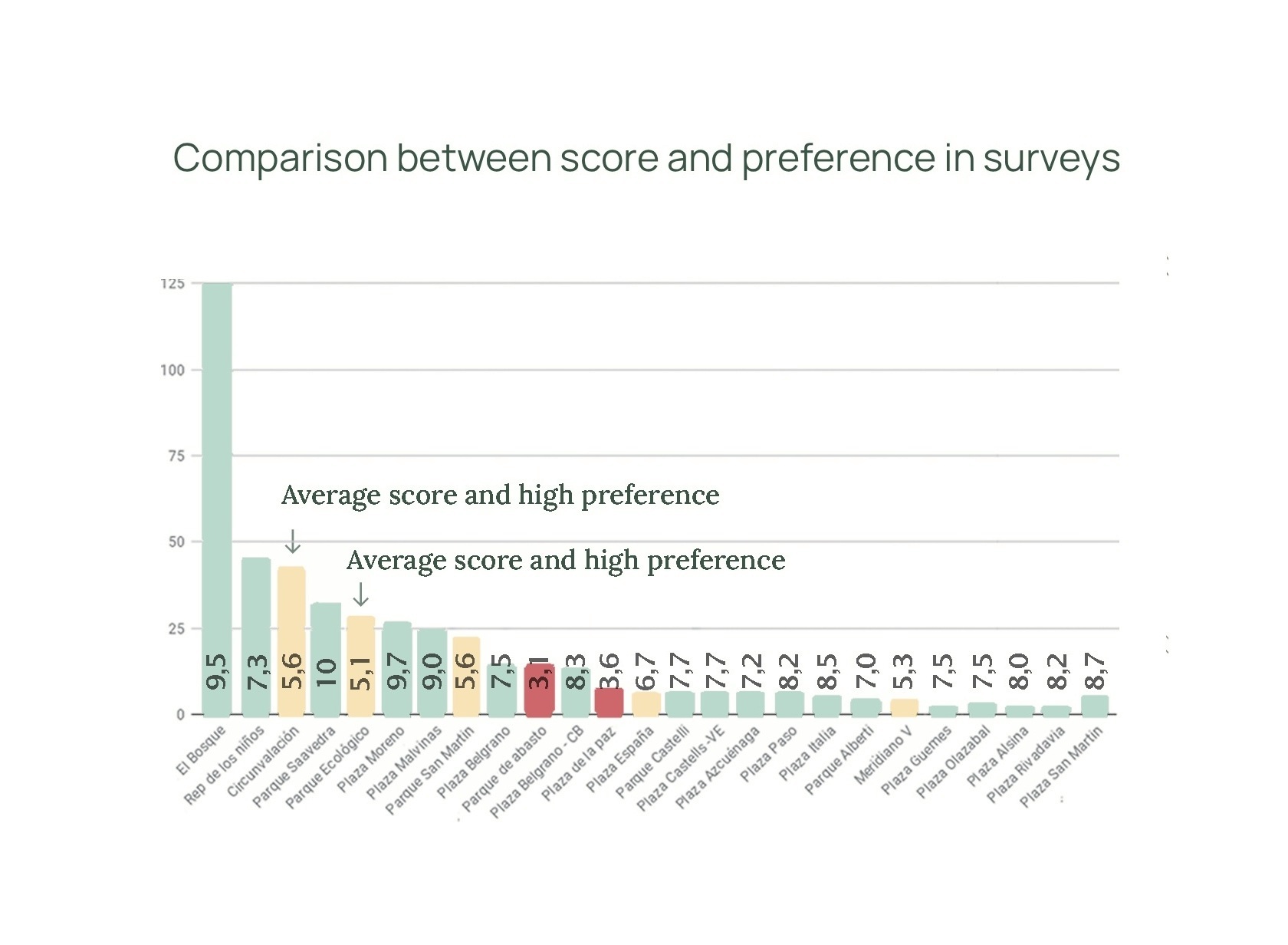
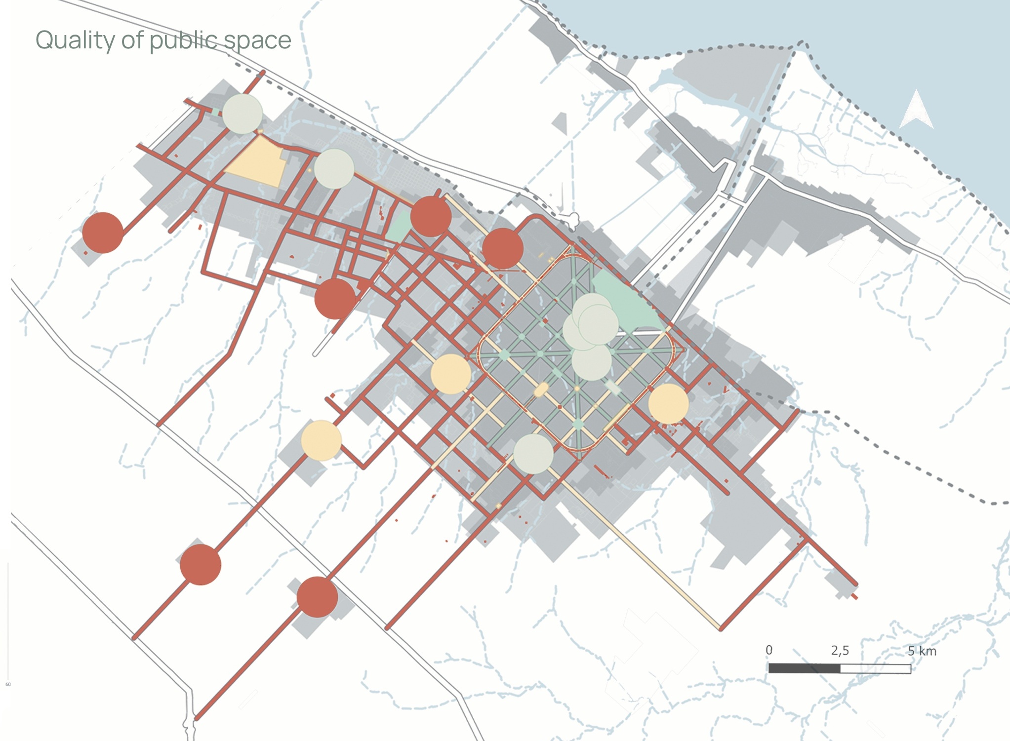
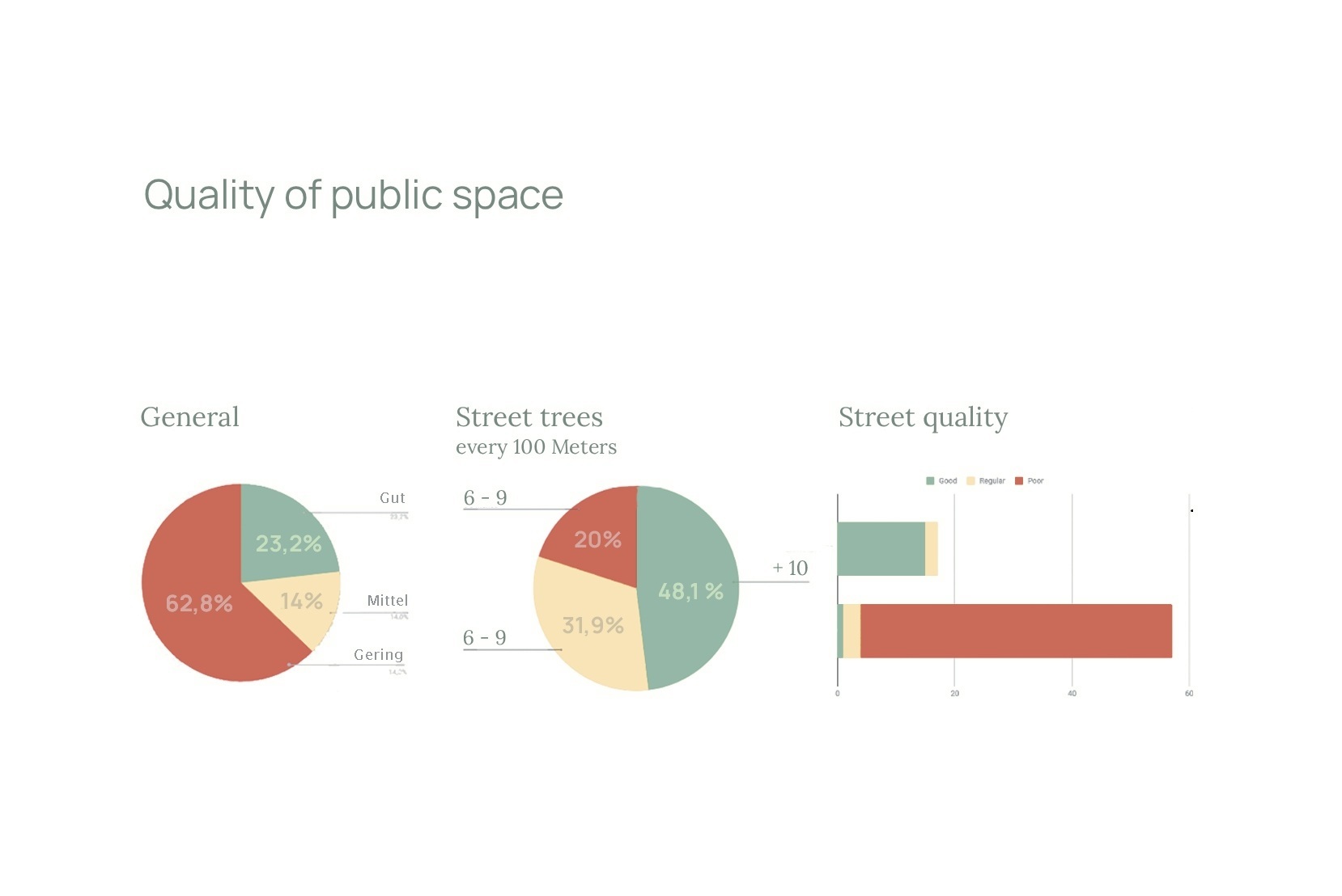
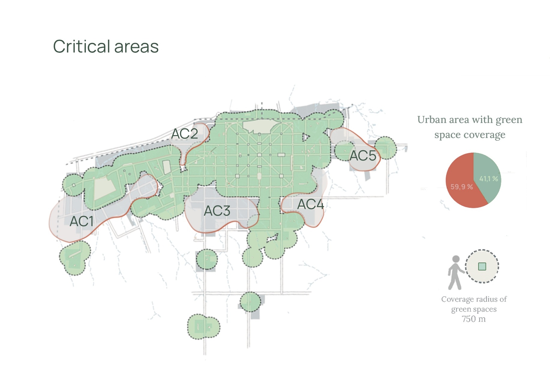
This research investigated the system of public spaces in La Plata, Argentina, as a structural factor in urban landscape quality. Working across three types of public space, I developed a spatial indicator framework to assess quality and mapped the results against population preferences — combining GIS analysis, field surveys (n=413), and quantitative data visualisation. The study produced spatial diagnoses, quality mapping, and strategic planning guidelines for a city of 1 million inhabitants. Methods included QGIS-based spatial analysis, statistical processing, and the development of cartographic communication materials.
➜ Download the complete thesis (PDF)
➜ Watch the thesis defense (video)