Urban Public Space Quality Assessment & GIS Mapping
La Plata, Argentina · 2020
🗺️ 413 field surveys 📍 207 spaces 🏙️ 4 urban zones
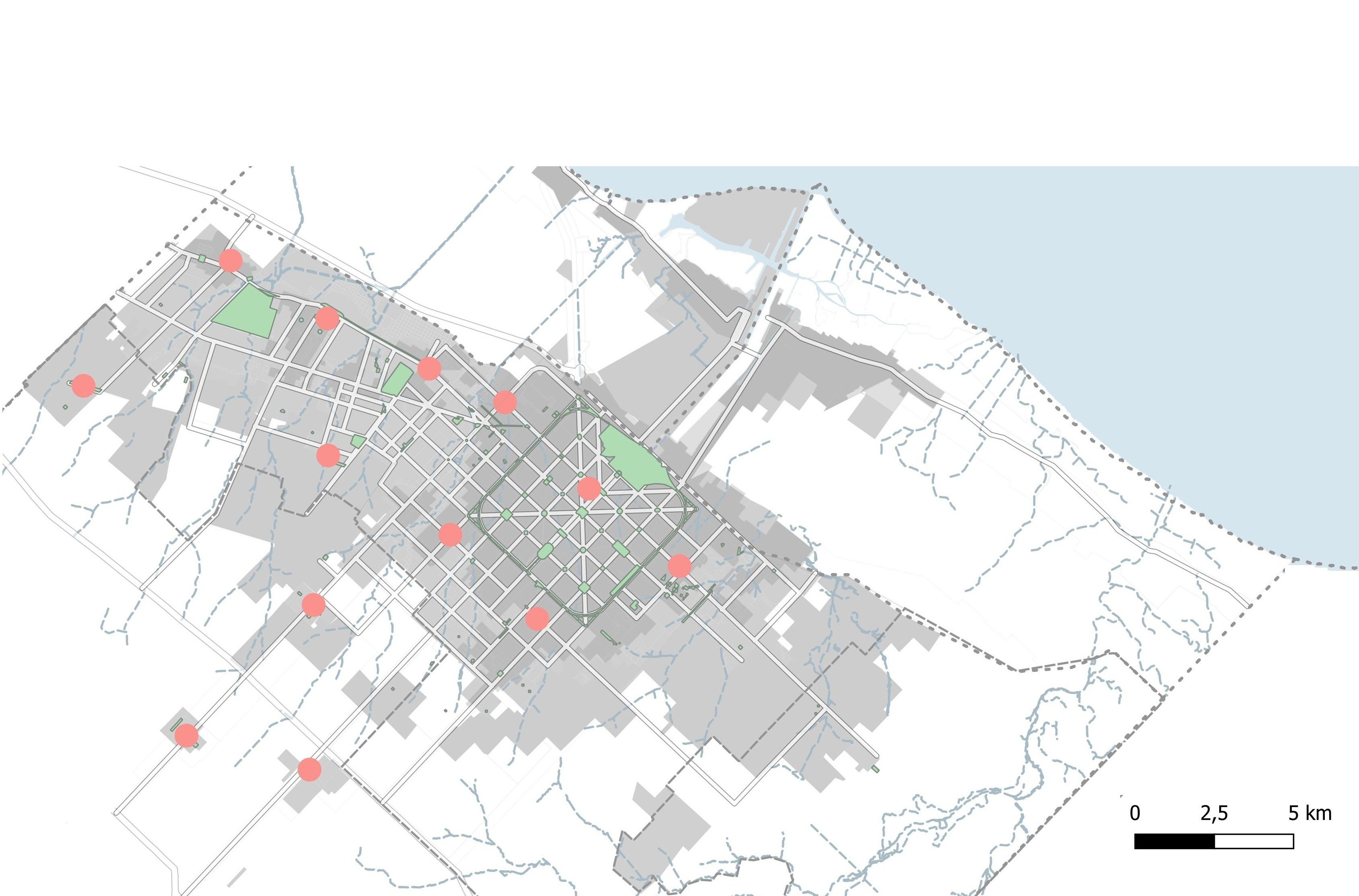
How do you measure the quality of urban life? This doctoral research developed a spatial framework to assess public space quality across La Plata (approx. 900,000 inhabitants), treating the public space system as a structural factor of urban landscape quality. Field surveys, GIS-based spatial analysis, and a custom scoring matrix were combined to evaluate three space types — green spaces, road spaces, and urban centralities — and produce actionable planning guidelines.
Methods & Tools
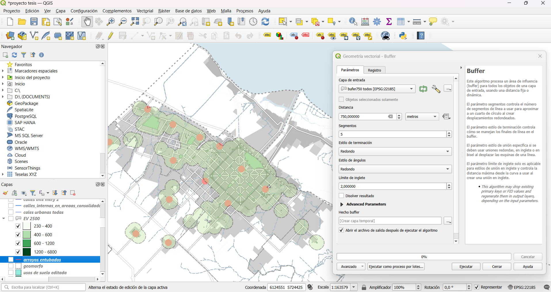
Each space was evaluated using a scoring matrix across four dimensions: accessibility, physical landscape attributes, social significance, and activity. Spatial analysis was conducted in QGIS using geoprocessing tools such as Buffer and Intersection.
The buffer tool (750 m walkability radius) defined accessibility catchment areas, while intersection operations were used to identify zones outside the service area, highlighting gaps in green space coverage. Cartographic outputs were designed in Photoshop, and InDesign.
Key outputs
- Quality diagnosis of 207 public spaces: 23% good, 14% fair, 63% poor
- Custom quality indicator matrix: accessibility · physical landscape · social meaning · activity
- Comparison between the matrix results and the survey data on social perception of these spaces
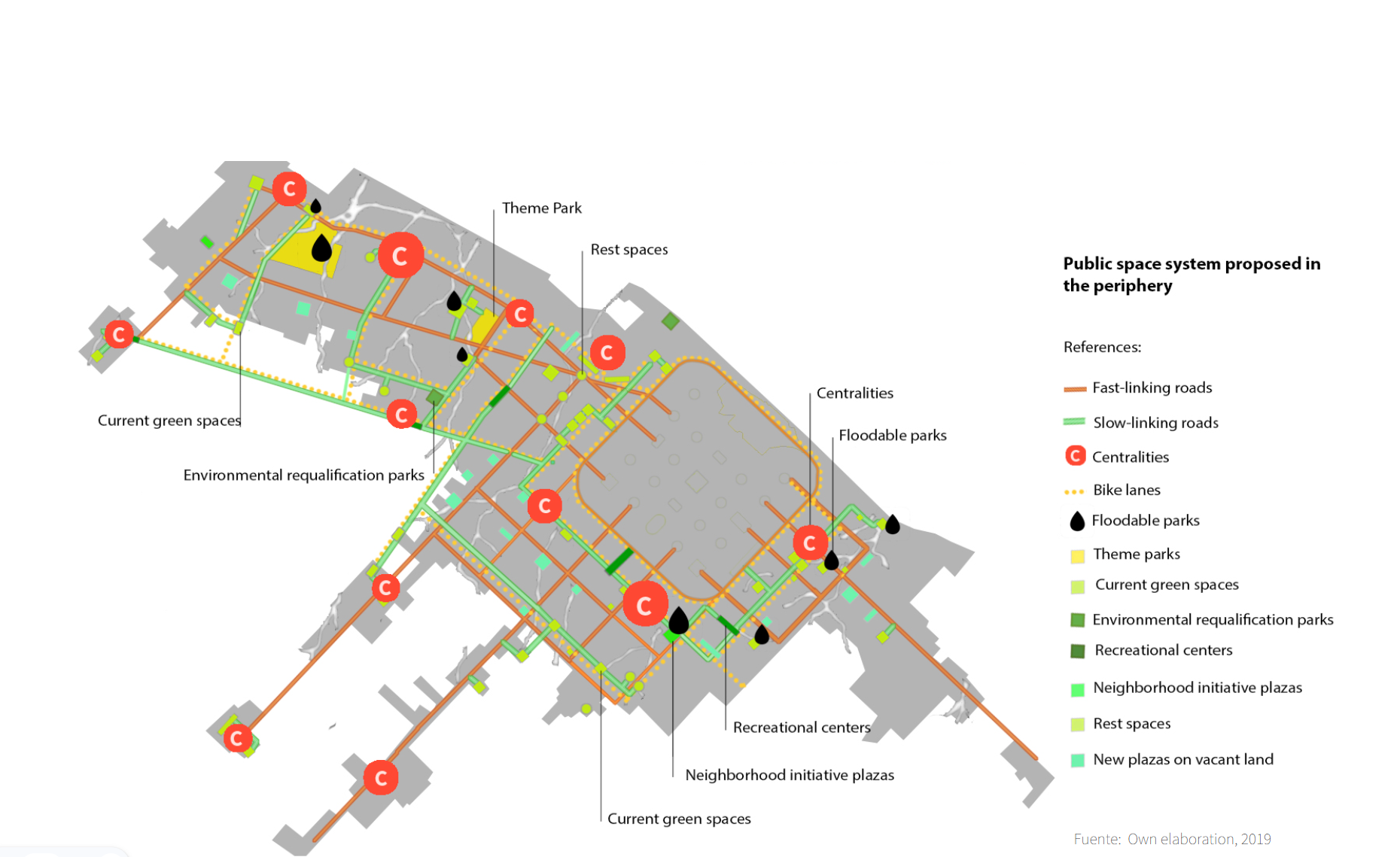
- Strategic planning guidelines: sustain, restore, create
- Interactive web map built with Leaflet.js and GeoJSON
- Integrated urban proposal based on the strategies developed
Publications derived from this research: Doctoral dissertation (UNLP) · Estudios Socioterritoriales · Revista Urbano (Chile) · Bitácora Urbano-Territorial (Colombia) · Revista de Arquitectura (Colombia)
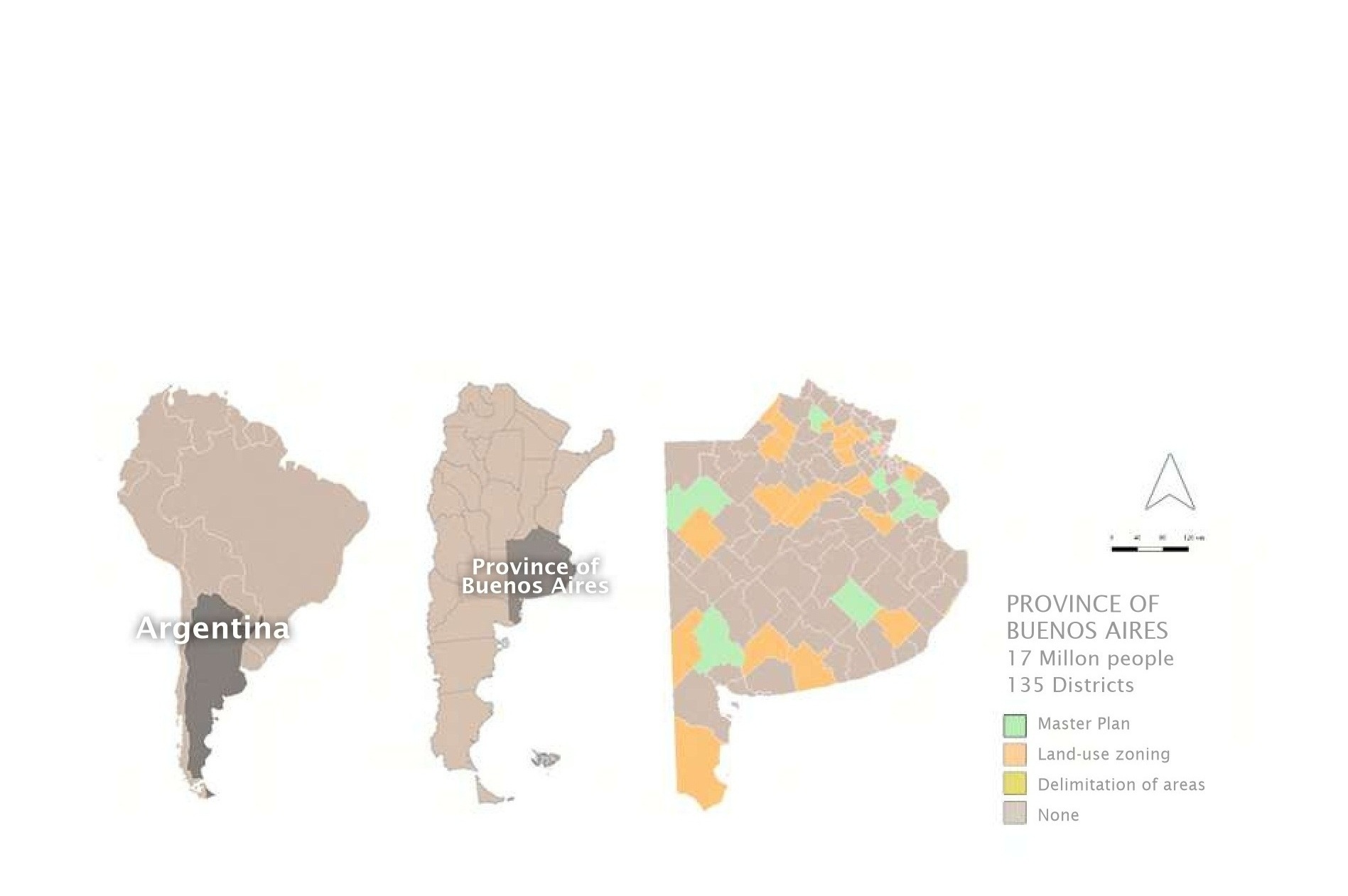
Territorial Planning of Buenos Aires Province
Buenos Aires Province, Argentina · 2020–2022
🏛️ 50 municipalities 📋 16 new zoning codes 📈 10% → 22% provincial coverage
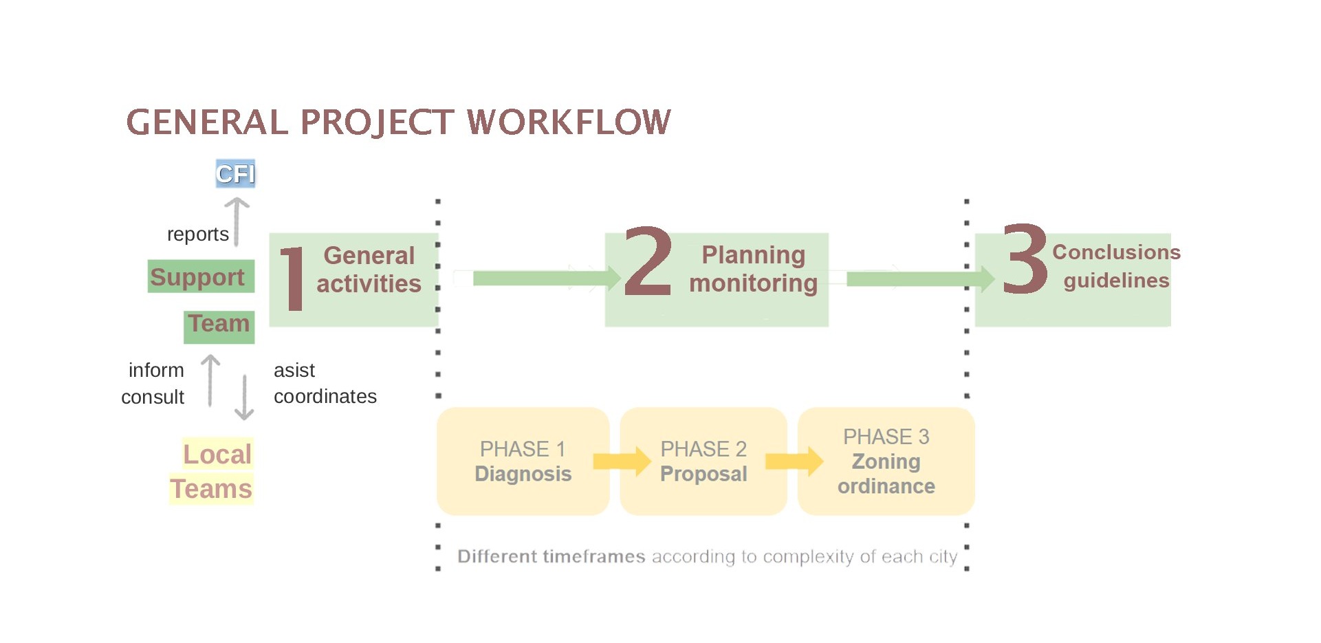
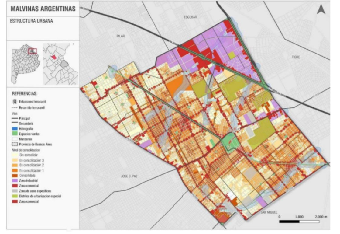
How do you update land use frameworks for an entire province — simultaneously, across 50 municipalities, during a pandemic? This applied planning project, commissioned by the Provincial Directorate of Urban and Territorial Planning and funded by the Federal Investment Council, provided technical assistance to 50 municipalities to develop or update their Urban and Territorial Planning Codes. As part of the Support Team, I co-designed the methodology, monitored progress, and produced planning guidelines that shaped public policy at provincial scale.
Context & Methods
At the project's launch, only 14 of 135 provincial municipalities (~10%) had a fully approved master plan — the remaining 73% had not advanced beyond preliminary zoning stages. The project was launch to directly adress this issue and was structured in three stages: general activities and methodology design, planning and monitoring, and synthesis of conclusions and policy guidelines. Each municipality was classified by complexity level (high / medium / low) based on regulatory obsolescence, population, and environmental region. Individual work plans, quality reporting templates, and a full methodological guide were developed to standardize the process across all teams.
Key outputs
- Methodology and planning guide for 50 municipal teams, covering diagnosis, zoning proposal, and ordinance phases
- Work plans according to complexity: 10 high · 15 medium · 25 low complexity municipalities
- Procedure for issuing status reports and quality report templates for each municipality
- Final synthesis report with provincial-scale policy guidelines
- 16 municipalities delivered approved Urban and Territorial Planning Codes, doubling provincial coverage
- Publication: Territorial planning in Buenos Aires
- Online training sessions uploaded to a YouTube channel